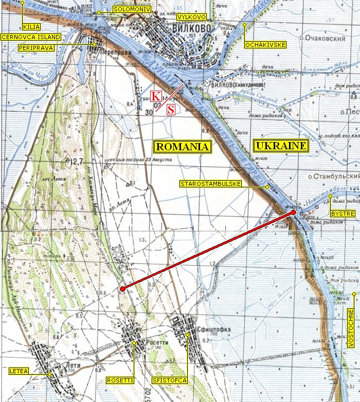
Lowered-resolution detail from MOSAIC: UKRAINIAN DANUBE DELTA which facilitates discussion of the effect of the Bystre Channel on the Letea Forest UNESCO Kernzone (Strictly Protected Zone), which occupies the triangle of green, bent so as to become concave toward the right, defined by the villages of Letea and Rosetti at its base, and by Periprava at its apex. Labels enclosed in rectangles, along with the 8-km-long thick red line from the western tip of the Bystre to just inside the Letea Kernzone, have been added. Spelling of Romanian names follows English usage rather than transliterating from the corresponding Russian.
HOME DISINFORMATION PEOPLE KUCHMA PUTIN YUSHCHENKO DANUBE MAPS