SATELLITE ENTIRE DELTA WITH KILIA TRIANGLE SUPPLEMENTS
![]()
441 x 526 jpg 147 x 105 jpg 271 x 140 gif
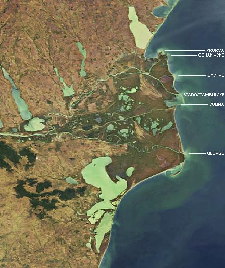
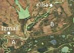
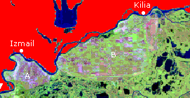
Left-hand satellite photograph is a detail, labels added, from the European Space Agency (ESA) photograph available at SATELLITE ROMANIA AND ENTIRE DELTA and as well at the place of original publication, the ESA web site at
www.esa.int/export/esaEO/SEMR5KXJD1E_index_1.html. Original publication dated 03-Dec-2004, Credits: ESA 2003. The middle photograph below, a detail from the left-hand photograph, labels Romanian-cultivated area A below the Ukrainian town of Izmail, and Romanian-cultivated area B (the "Kilia Triangle") below the Ukrainian town of Kilia. The right-hand photograph is a detail from SATELLITE ENTIRE DELTA WITH KEY LANDMARKS SUPPLEMENT and identifies the same two Romanian-cultivated areas.